Geolocate

Sant Pere de Ribes topographic map

Click on the map to display elevation.

About this map
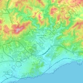
Name: Sant Pere de Ribes topographic map, elevation, terrain.

Location: Sant Pere de Ribes, Garraf, Barcelona, Catalonia, Spain (41.21850 1.72245 41.29471 1.83624)

Average elevation: 312 ft

Minimum elevation: -3 ft

Maximum elevation: 1,155 ft

Other topographic maps

Click on a map to view its topography, its elevation and its terrain.

Camp de l'Anglès

Spain > Catalonia > Garraf > Sant Pere de Ribes

Average elevation: 240 ft

Gear up for your next adventure:

🪶Compact Camp Shovel - Folding shovel for campsite tasks
🪶Multi‑Purpose Knife - Useful blade for camp and trail
🧤Hiking Gloves - Protective gloves for rugged trails
🛡️Bear Spray Outdoor - Protection in bear country hikes
🪵Folding Camp Saw - Compact saw for wood and campsite work

As an Amazon Associate, this site earns from qualifying purchases at no extra cost to you.