
灌水镇 topographic map
Interactive map
Click on the map to display elevation.
About this map
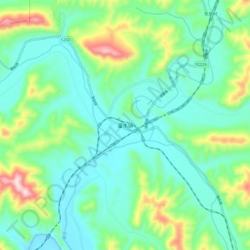
Name: 灌水镇 topographic map, elevation, terrain.
Location: 灌水镇, 宽甸满族自治县, 丹东市, 辽宁省, 中国 (40.83377 124.53994 40.91377 124.61994)
Average elevation: 843 ft
Minimum elevation: 509 ft
Maximum elevation: 1,844 ft
Other topographic maps
Click on a map to view its topography, its elevation and its terrain.