
九连山国家级自然保护区 topographic map
Interactive map
Click on the map to display elevation.
About this map
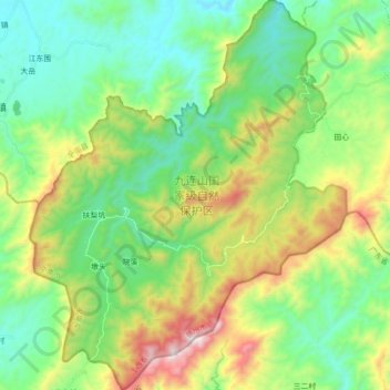
Name: 九连山国家级自然保护区 topographic map, elevation, terrain.
Location: 九连山国家级自然保护区, 九连山镇, 龙南市, 赣州市, 江西省, 中国 (24.48885 114.38199 24.64888 114.52545)
Average elevation: 2,096 ft
Minimum elevation: 1,007 ft
Maximum elevation: 4,537 ft