
Khadra topographic map
Interactive map
Click on the map to display elevation.
About this map
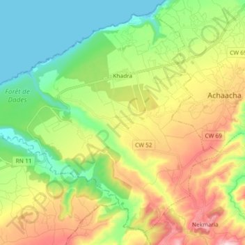
Name: Khadra topographic map, elevation, terrain.
Location: Khadra, daïra Achaacha, Mostaganem, Algérie (36.17852 0.48654 36.28435 0.63275)
Average elevation: 518 ft
Minimum elevation: 0 ft
Maximum elevation: 1,371 ft