
巴音布鲁克镇 topographic map
Interactive map
Click on the map to display elevation.
About this map
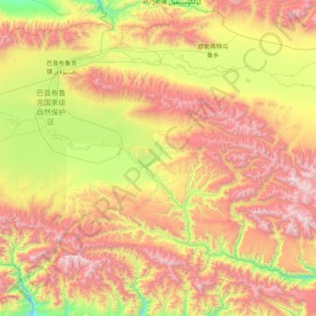
Name: 巴音布鲁克镇 topographic map, elevation, terrain.
Location: 巴音布鲁克镇, 和静县, 巴音郭楞蒙古自治州, 新疆维吾尔自治区, 中国 (42.27574 83.99887 43.17353 85.41814)
Average elevation: 9,573 ft
Minimum elevation: 5,909 ft
Maximum elevation: 15,072 ft
Other topographic maps
Click on a map to view its topography, its elevation and its terrain.