
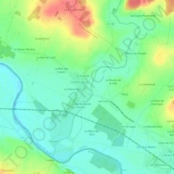
Le Moulin Neuf topographic map
Interactive map
Click on the map to display elevation.
About this map
Name: Le Moulin Neuf topographic map, elevation, terrain.
Average elevation: 194 ft
Minimum elevation: 118 ft
Maximum elevation: 341 ft
Other topographic maps
Click on a map to view its topography, its elevation and its terrain.
Les Vignes de Molière
France > Centre-Val de Loire > Indre-et-Loire > Descartes
Les Vignes de Molière, Descartes, Loches, Indre-et-Loire, Centre-Val de Loire, France métropolitaine, 37160, France
Average elevation: 272 ft
La Gare
France > Centre-Val de Loire > Indre-et-Loire > Descartes
La Gare, Descartes, Loches, Indre-et-Loire, Centre-Val de Loire, France métropolitaine, 37160, France
Average elevation: 253 ft
L'Enfer
France > Centre-Val de Loire > Indre-et-Loire > Descartes
L'Enfer, Descartes, Loches, Indre-et-Loire, Centre-Val de Loire, France métropolitaine, 37160, France
Average elevation: 256 ft