
Little Eaton topographic map
Click on the map to display elevation.
About this map
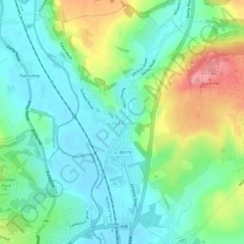
Name: Little Eaton topographic map, elevation, terrain.
Location: Little Eaton, Erewash, Derbyshire, England, United Kingdom (52.95433 -1.47984 52.98386 -1.42888)
Average elevation: 269 ft
Minimum elevation: 161 ft
Maximum elevation: 515 ft
Other topographic maps
Click on a map to view its topography, its elevation and its terrain.