Geolocate

Platanares topographic map

Click on the map to display elevation.

About this map

Name: Platanares topographic map, elevation, terrain.

Location: Platanares, Cantón Pérez Zeledón, San Jose Province, 11906, Costa Rica (9.12672 -83.70485 9.25610 -83.59185)

Average elevation: 2,441 ft

Minimum elevation: 92 ft

Maximum elevation: 3,937 ft

Other topographic maps

Click on a map to view its topography, its elevation and its terrain.
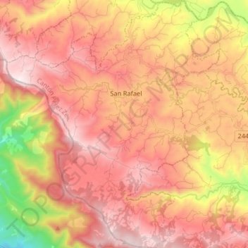
Berlín

Costa Rica > Cantón Pérez Zeledón > Páramo

Average elevation: 4,032 ft

Fortuna

Costa Rica > Cantón Pérez Zeledón > San Pedro

Average elevation: 1,857 ft

Herradura

Costa Rica > Cantón Pérez Zeledón > Rivas

Average elevation: 5,653 ft

Gear up for your next adventure:

🌎3D Topographic Globes - Raised relief globes for a tactile understanding of geography
📱Solar Portable Charger - Solar power bank for charging devices off‑grid
☀️Outdoor Sunscreen - High protection sunscreen for outdoor activities
🛠️Outdoor Gear Repair Kit - Essential tools to fix gear on the trail
🧺Microfiber Travel Towels - Compact and fast-drying towels for trail use

As an Amazon Associate, this site earns from qualifying purchases at no extra cost to you.