
Cerro de La Silla topographic map
Interactive map
Click on the map to display elevation.
About this map
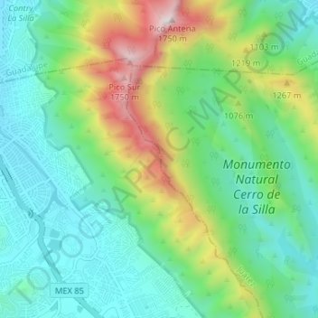
Name: Cerro de La Silla topographic map, elevation, terrain.
Location: Cerro de La Silla, Monterrey, Juárez, Nuevo León, México (25.57812 -100.24388 25.63675 -100.21618)
Average elevation: 2,890 ft
Minimum elevation: 1,772 ft
Maximum elevation: 5,804 ft