
Hotazel topographic map
Interactive map
Click on the map to display elevation.
About this map
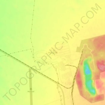
Name: Hotazel topographic map, elevation, terrain.
Average elevation: 3,478 ft
Minimum elevation: 3,291 ft
Maximum elevation: 3,599 ft
Other topographic maps
Click on a map to view its topography, its elevation and its terrain.
Dithakong
South Africa > Northern Cape > John Taolo Gaetsewe District Municipality > Joe Morolong Local Municipality
Dithakong, Joe Morolong Local Municipality, John Taolo Gaetsewe District Municipality, Northern Cape, South Africa
Average elevation: 4,150 ft
Madibeng
South Africa > Northern Cape > John Taolo Gaetsewe District Municipality > Joe Morolong Local Municipality
Madibeng, Joe Morolong Local Municipality, John Taolo Gaetsewe District Municipality, Northern Cape, South Africa
Average elevation: 3,317 ft