
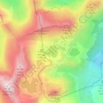
Lac Gentau topographic map
Interactive map
Click on the map to display elevation.
About this map
Name: Lac Gentau topographic map, elevation, terrain.
Average elevation: 6,516 ft
Minimum elevation: 5,161 ft
Maximum elevation: 7,723 ft
Other topographic maps
Click on a map to view its topography, its elevation and its terrain.
Laruns
France > Nouvelle-Aquitaine > Laruns > Laruns
Laruns, Oloron-Sainte-Marie, Pyrénées-Atlantiques, Nouvelle-Aquitaine, France métropolitaine, 64440, France
Average elevation: 5,459 ft