
Source Is Shapefile From Town topographic map
Interactive map
Click on the map to display elevation.
About this map
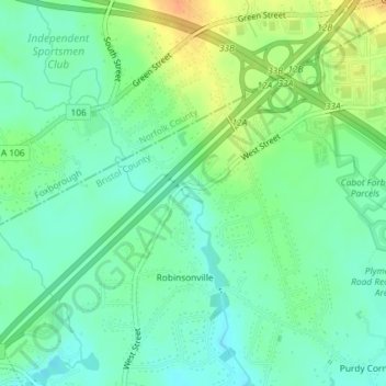
Name: Source Is Shapefile From Town topographic map, elevation, terrain.
Average elevation: 164 ft
Minimum elevation: 118 ft
Maximum elevation: 243 ft
Other topographic maps
Click on a map to view its topography, its elevation and its terrain.
Robinsonville
États-Unis d'Amérique > Massachusetts > Bristol County > Mansfield > Robinsonville
Robinsonville, Mansfield, Bristol County, Massachusetts, 02048-1712, États-Unis d'Amérique
Average elevation: 157 ft