
Lödingsen topographic map
Interactive map
Click on the map to display elevation.
About this map
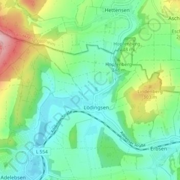
Name: Lödingsen topographic map, elevation, terrain.
Average elevation: 774 ft
Minimum elevation: 571 ft
Maximum elevation: 1,280 ft
Other topographic maps
Click on a map to view its topography, its elevation and its terrain.
Erbsen
Deutschland > Niedersachsen > Landkreis Göttingen > Adelebsen
Erbsen, Adelebsen, Landkreis Göttingen, Niedersachsen, Deutschland
Average elevation: 774 ft
Eberhausen
Deutschland > Niedersachsen > Landkreis Göttingen > Adelebsen
Eberhausen, Adelebsen, Landkreis Göttingen, Niedersachsen, Deutschland
Average elevation: 804 ft