
Jagannadhapuram topographic map
Interactive map
Click on the map to display elevation.
About this map
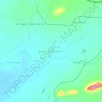
Name: Jagannadhapuram topographic map, elevation, terrain.
Location: Jagannadhapuram, K.Kotapadu, Anakapalli, Andhra Pradesh, India (17.90108 83.04793 17.94108 83.08793)
Average elevation: 302 ft
Minimum elevation: 220 ft
Maximum elevation: 682 ft