
Woodsville topographic map
Interactive map
Click on the map to display elevation.
About this map
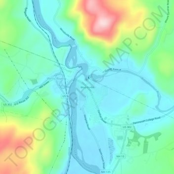
Name: Woodsville topographic map, elevation, terrain.
Average elevation: 640 ft
Minimum elevation: 390 ft
Maximum elevation: 1,365 ft
Other topographic maps
Click on a map to view its topography, its elevation and its terrain.
Pike
United States > New Hampshire > Grafton County > Haverhill
Pike, Haverhill, Grafton County, New Hampshire, 03765, United States
Average elevation: 942 ft
Mountain Lakes
United States > New Hampshire > Grafton County > Haverhill
Mountain Lakes, Haverhill, Grafton County, New Hampshire, 03740, United States
Average elevation: 922 ft
North Haverhill
United States > New Hampshire > Grafton County > Haverhill
North Haverhill, Haverhill, Grafton County, New Hampshire, 03774, United States
Average elevation: 489 ft