
牛头山镇 topographic map
Interactive map
Click on the map to display elevation.
About this map
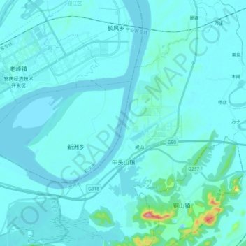
Name: 牛头山镇 topographic map, elevation, terrain.
Location: 牛头山镇, 贵池区, 池州市, 安徽省, 247100, 中国 (30.42877 117.18133 30.59079 117.33401)
Average elevation: 69 ft
Minimum elevation: -3 ft
Maximum elevation: 1,135 ft
Other topographic maps
Click on a map to view its topography, its elevation and its terrain.