
Vila de Cruces topographic map
Interactive map
Click on the map to display elevation.
About this map
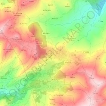
Name: Vila de Cruces topographic map, elevation, terrain.
Location: Vila de Cruces, O Deza, Pontevedra, Galicien, 36590, Spanien (42.77372 -8.18994 42.81372 -8.14994)
Average elevation: 1,483 ft
Minimum elevation: 899 ft
Maximum elevation: 1,959 ft
Other topographic maps
Click on a map to view its topography, its elevation and its terrain.