
太拥 topographic map
Interactive map
Click on the map to display elevation.
About this map
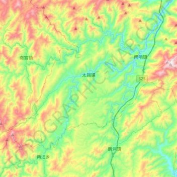
Name: 太拥 topographic map, elevation, terrain.
Location: 太拥, 剑河县, 黔东南苗族侗族自治州, 贵州省, 中国 (26.35040 108.28582 26.55112 108.58417)
Average elevation: 2,766 ft
Minimum elevation: 1,457 ft
Maximum elevation: 5,207 ft
Other topographic maps
Click on a map to view its topography, its elevation and its terrain.