
Ludwigshof topographic map
Interactive map
Click on the map to display elevation.
About this map
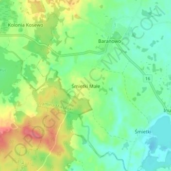
Name: Ludwigshof topographic map, elevation, terrain.
Average elevation: 472 ft
Minimum elevation: 394 ft
Maximum elevation: 607 ft
Other topographic maps
Click on a map to view its topography, its elevation and its terrain.
Peitschendorf
Polen > Woiwodschaft Ermland-Masuren > powiat mrągowski
Peitschendorf, gmina Piecki, powiat mrągowski, Woiwodschaft Ermland-Masuren, 11-710, Polen
Average elevation: 489 ft