Geolocate

Großenseebach topographic map

Click on the map to display elevation.

About this map

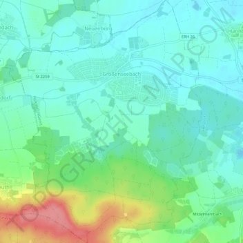
Name: Großenseebach topographic map, elevation, terrain.

Location: Großenseebach, Heßdorf (VGem), Landkreis Erlangen-Höchstadt, Bavaria, 91091, Germany (49.60790 10.85222 49.64180 10.89461)

Average elevation: 1,010 ft

Minimum elevation: 932 ft

Maximum elevation: 1,224 ft

Other topographic maps

Click on a map to view its topography, its elevation and its terrain.

Gear up for your next adventure:

🦺Reflective Outdoor Gear - Safety gear for low‑light conditions
🧦Merino Wool Socks - Moisture-wicking, blister-preventing socks for long treks
🧭Outdoor Navigation Book - Learn advanced navigation skills
🧭Map Reading Tools - Tools and kits for map navigation
🛶Inflatable Kayak - Portable kayak for rivers, lakes, and expeditions

As an Amazon Associate, this site earns from qualifying purchases at no extra cost to you.