
Bir Haddada topographic map
Interactive map
Click on the map to display elevation.
About this map
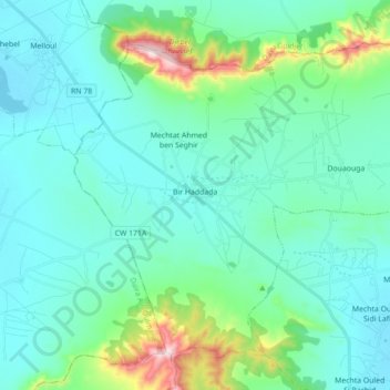
Name: Bir Haddada topographic map, elevation, terrain.
Location: Bir Haddada, Daïra Aïn Azal, Sétif, Algérie (35.90216 5.37623 36.02118 5.55211)
Average elevation: 3,255 ft
Minimum elevation: 2,949 ft
Maximum elevation: 4,764 ft
Other topographic maps
Click on a map to view its topography, its elevation and its terrain.
Aïn Azal
Algérie > Sétif > Daïra Aïn Azal
Aïn Azal, Daïra Aïn Azal, Sétif, 19007, Algérie
Average elevation: 3,507 ft