
湾岭镇 topographic map
Interactive map
Click on the map to display elevation.
About this map
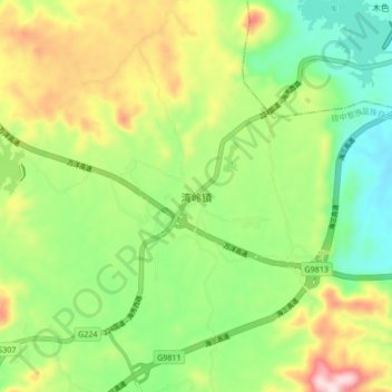
Name: 湾岭镇 topographic map, elevation, terrain.
Location: 湾岭镇, 琼中黎族苗族自治县, 海南省, 中国 (19.13440 109.89698 19.21440 109.97698)
Average elevation: 879 ft
Minimum elevation: 374 ft
Maximum elevation: 1,690 ft
Other topographic maps
Click on a map to view its topography, its elevation and its terrain.