
Valdeganga topographic map
Interactive map
Click on the map to display elevation.
About this map
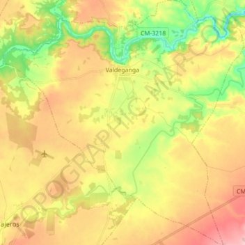
Name: Valdeganga topographic map, elevation, terrain.
Location: Valdeganga, Albacete, Castilla-La Mancha, 02150, España (39.05905 -1.74443 39.16625 -1.60915)
Average elevation: 2,188 ft
Minimum elevation: 1,893 ft
Maximum elevation: 2,480 ft