
Morrisonville topographic map
Interactive map
Click on the map to display elevation.
About this map
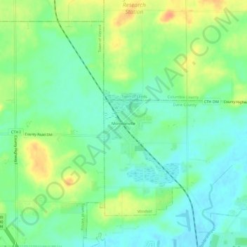
Name: Morrisonville topographic map, elevation, terrain.
Average elevation: 981 ft
Minimum elevation: 928 ft
Maximum elevation: 1,063 ft
Other topographic maps
Click on a map to view its topography, its elevation and its terrain.
Lake Windsor
United States > Wisconsin > Dane County > Windsor
Lake Windsor, Windsor, Dane County, Wisconsin, 53598, United States
Average elevation: 902 ft