
Ipiales topographic map
Interactive map
Click on the map to display elevation.
About this map
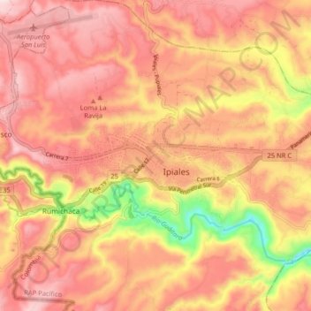
Name: Ipiales topographic map, elevation, terrain.
Location: Ipiales, Nariño, 524060, Colombia (0.78786 -77.68021 0.86786 -77.60021)
Average elevation: 9,452 ft
Minimum elevation: 8,609 ft
Maximum elevation: 9,902 ft