
Khantys-Mansis topographic map
Interactive map
Click on the map to display elevation.
About this map
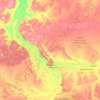
Name: Khantys-Mansis topographic map, elevation, terrain.
Location: Khantys-Mansis, District fédéral de l'Oural, Russie (59.31934 66.08182 64.43934 71.20182)
Average elevation: 243 ft
Minimum elevation: 20 ft
Maximum elevation: 840 ft
Other topographic maps
Click on a map to view its topography, its elevation and its terrain.
Oural
Oural, Берёзовский район, Khantys-Mansis, District fédéral de l'Oural, Russie
Average elevation: 4,708 ft
Зеленая зона возле парковки, Быстринске месторождение
Зеленая зона возле парковки, Быстринске месторождение, Сургутский район, Khantys-Mansis, District fédéral de l'Oural, Russie
Average elevation: 177 ft