
Kraï de Transbaïkalie topographic map
Interactive map
Click on the map to display elevation.
About this map
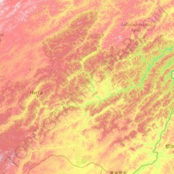
Name: Kraï de Transbaïkalie topographic map, elevation, terrain.
Average elevation: 2,933 ft
Minimum elevation: 1,224 ft
Maximum elevation: 7,703 ft
Other topographic maps
Click on a map to view its topography, its elevation and its terrain.
Каларский район
Russie > Kraï de Transbaïkalie
Каларский район, Kraï de Transbaïkalie, District fédéral extrême-oriental, Russie
Average elevation: 3,583 ft