
Dolores Merendón topographic map
Interactive map
Click on the map to display elevation.
About this map
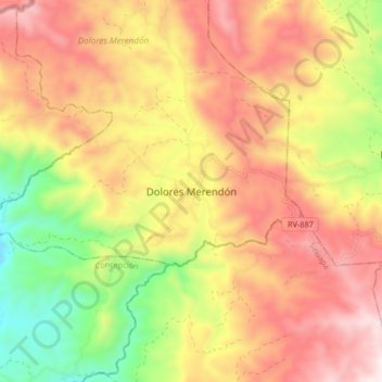
Name: Dolores Merendón topographic map, elevation, terrain.
Location: Dolores Merendón, Ocotepeque, Honduras (14.49432 -89.16530 14.57432 -89.08530)
Average elevation: 5,059 ft
Minimum elevation: 3,553 ft
Maximum elevation: 6,342 ft