
La Canaria topographic map
Interactive map
Click on the map to display elevation.
About this map
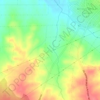
Name: La Canaria topographic map, elevation, terrain.
Location: La Canaria, Arroyo de San Serván, Badajoz, Extremadura, Spain (38.83426 -6.47750 38.85426 -6.45750)
Average elevation: 797 ft
Minimum elevation: 689 ft
Maximum elevation: 922 ft