
La Chapelle-Saint-Mesmin topographic map
Interactive map
Click on the map to display elevation.
About this map
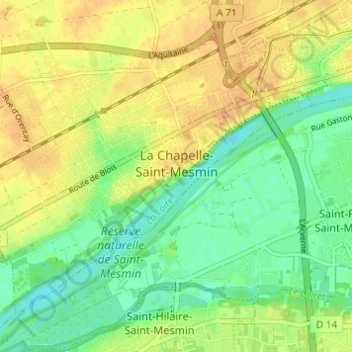
Name: La Chapelle-Saint-Mesmin topographic map, elevation, terrain.
Average elevation: 328 ft
Minimum elevation: 276 ft
Maximum elevation: 374 ft
La superficie de la commune est de 8,96 km2 ; son altitude varie entre 87 et 113 mètres.