
Wazuka topographic map
Interactive map
Click on the map to display elevation.
About this map
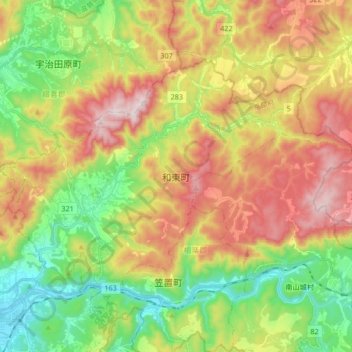
Name: Wazuka topographic map, elevation, terrain.
Location: Wazuka, Soraku County, Kyoto Prefecture, Japan (34.76323 135.86038 34.85501 136.02846)
Average elevation: 1,020 ft
Minimum elevation: 108 ft
Maximum elevation: 2,195 ft
Other topographic maps
Click on a map to view its topography, its elevation and its terrain.
Tsuzuki County
Ide, Tsuzuki County, Kyoto Prefecture, 610-0301, Japan
Average elevation: 597 ft