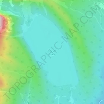
Phelps Lake topographic map
Interactive map
Click on the map to display elevation.
About this map
Name: Phelps Lake topographic map, elevation, terrain.
Average elevation: 6,837 ft
Minimum elevation: 6,506 ft
Maximum elevation: 8,005 ft

Click on the map to display elevation.
Name: Phelps Lake topographic map, elevation, terrain.
Average elevation: 6,837 ft
Minimum elevation: 6,506 ft
Maximum elevation: 8,005 ft