
Cocora topographic map
Interactive map
Click on the map to display elevation.
About this map
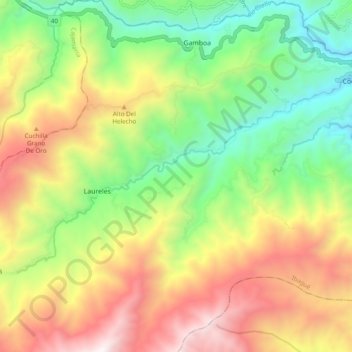
Name: Cocora topographic map, elevation, terrain.
Location: Cocora, Ibagué, Tolima, Colombie (4.34774 -75.38616 4.40109 -75.28922)
Average elevation: 6,480 ft
Minimum elevation: 3,829 ft
Maximum elevation: 9,951 ft
Other topographic maps
Click on a map to view its topography, its elevation and its terrain.