
Isla Iguana topographic map
Interactive map
Click on the map to display elevation.
About this map
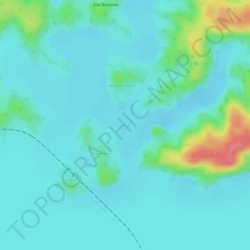
Name: Isla Iguana topographic map, elevation, terrain.
Location: Isla Iguana, Colón, Distrito Colón, Colón, Panamá (9.28422 -79.86420 9.28563 -79.86238)
Average elevation: 118 ft
Minimum elevation: 66 ft
Maximum elevation: 318 ft
Other topographic maps
Click on a map to view its topography, its elevation and its terrain.