
Hueycantenango topographic map
Interactive map
Click on the map to display elevation.
About this map
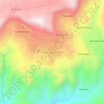
Name: Hueycantenango topographic map, elevation, terrain.
Location: Hueycantenango, José Joaquín de Herrera, Guerrero, México (17.42904 -99.04462 17.46904 -99.00462)
Average elevation: 4,944 ft
Minimum elevation: 3,156 ft
Maximum elevation: 6,585 ft