
Rohrberg topographic map
Interactive map
Click on the map to display elevation.
About this map
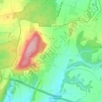
Name: Rohrberg topographic map, elevation, terrain.
Average elevation: 1,050 ft
Minimum elevation: 840 ft
Maximum elevation: 1,388 ft
Other topographic maps
Click on a map to view its topography, its elevation and its terrain.
Wahlhausen
Duitsland > Thüringen > Landkreis Eichsfeld
Wahlhausen, Hanstein-Rusteberg, Landkreis Eichsfeld, Thüringen, Duitsland
Average elevation: 830 ft
Klusberg
Duitsland > Thüringen > Landkreis Eichsfeld > Großbartloff
Klusberg, Großbartloff, Westerwald-Obereichsfeld, Landkreis Eichsfeld, Thüringen, Duitsland
Average elevation: 1,220 ft