
Lake in the Clouds topographic map
Interactive map
Click on the map to display elevation.
About this map
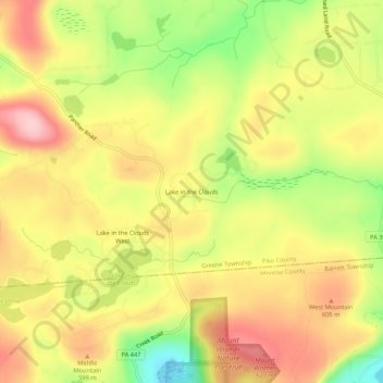
Name: Lake in the Clouds topographic map, elevation, terrain.
Average elevation: 1,841 ft
Minimum elevation: 1,493 ft
Maximum elevation: 2,113 ft
Other topographic maps
Click on a map to view its topography, its elevation and its terrain.
Lake Wallenpaupack
United States > Pennsylvania > Pike County > Greene Township
Lake Wallenpaupack, Greene Township, Pike County, Pennsylvania, United States
Average elevation: 1,388 ft
Greentown
United States > Pennsylvania > Pike County > Greene Township
Greentown, Greene Township, Pike County, Pennsylvania, 18426, United States
Average elevation: 1,473 ft