
Gibsonburg topographic map
Interactive map
Click on the map to display elevation.
About this map
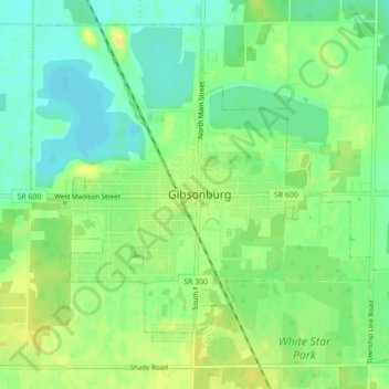
Name: Gibsonburg topographic map, elevation, terrain.
Location: Gibsonburg, Sandusky County, Ohio, United States (41.37024 -83.33900 41.39908 -83.29511)
Average elevation: 676 ft
Minimum elevation: 636 ft
Maximum elevation: 712 ft
Other topographic maps
Click on a map to view its topography, its elevation and its terrain.
Bellevue
United States > Ohio > Sandusky County
Bellevue, Sandusky County, Ohio, United States
Average elevation: 758 ft
Fremont
United States > Ohio > Sandusky County
Fremont, Sandusky County, Ohio, 43420, United States
Average elevation: 623 ft