
Bonbonon topographic map
Interactive map
Click on the map to display elevation.
About this map
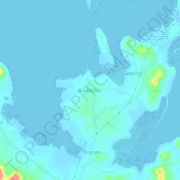
Name: Bonbonon topographic map, elevation, terrain.
Location: Bonbonon, Bohol, Central Visayas, Philippines (10.10472 124.55911 10.14472 124.59911)
Average elevation: 20 ft
Minimum elevation: -3 ft
Maximum elevation: 315 ft
Other topographic maps
Click on a map to view its topography, its elevation and its terrain.