Geolocate

Prigen topographic map

Click on the map to display elevation.

About this map
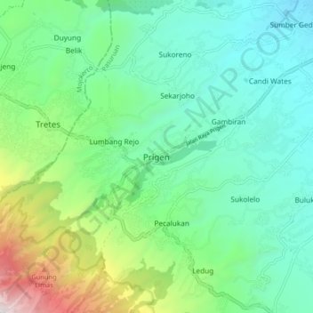
Name: Prigen topographic map, elevation, terrain.

Location: Prigen, Pasuruan, East Java, Java, Indonesia (-7.72055 112.60062 -7.64055 112.68062)

Average elevation: 2,051 ft

Minimum elevation: 515 ft

Maximum elevation: 6,558 ft

Other topographic maps

Click on a map to view its topography, its elevation and its terrain.

Batas Desa Sumberanyar

Indonesia > East Java > Pasuruan

Average elevation: 128 ft

Gear up for your next adventure:

🚁Photography Drones - Capture stunning aerial views of landforms and topography
👖Convertible Hiking Pants - Versatile zip-off pants for changing altitudes and temperatures
🧦Merino Wool Socks - Moisture-wicking, blister-preventing socks for long treks
🧥Men's Rain Shells - Premium waterproof and breathable jackets for mountain weather
📱Solar Portable Charger - Solar power bank for charging devices off‑grid

As an Amazon Associate, this site earns from qualifying purchases at no extra cost to you.