
Leke topographic map
Interactive map
Click on the map to display elevation.
About this map
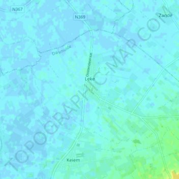
Name: Leke topographic map, elevation, terrain.
Location: Leke, Dixmude, Flandre-Occidentale, Flandre, Belgique (51.08512 2.86628 51.11623 2.93976)
Average elevation: 7 ft
Minimum elevation: -7 ft
Maximum elevation: 56 ft
Other topographic maps
Click on a map to view its topography, its elevation and its terrain.
Vladslo
Belgique > Flandre-Occidentale > Dixmude > Dixmude
Vladslo, Dixmude, Flandre-Occidentale, Flandre, Belgique
Average elevation: 23 ft