
Thumel topographic map
Interactive map
Click on the map to display elevation.
About this map
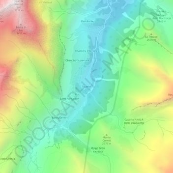
Name: Thumel topographic map, elevation, terrain.
Location: Thumel, Rhêmes-Notre-Dame, Valle d'Aosta, Italia (45.51813 7.08281 45.55813 7.12281)
Average elevation: 7,956 ft
Minimum elevation: 5,935 ft
Maximum elevation: 11,677 ft