孔嶺 Hung Leng topographic map
Interactive map
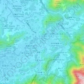
Click on the map to display elevation.
About this map
Name: 孔嶺 Hung Leng topographic map, elevation, terrain.
Average elevation: 180 ft
Minimum elevation: 13 ft
Maximum elevation: 1,463 ft

Click on the map to display elevation.
Name: 孔嶺 Hung Leng topographic map, elevation, terrain.
Average elevation: 180 ft
Minimum elevation: 13 ft
Maximum elevation: 1,463 ft