
Thank you for supporting this site ❤️
Make a donation
Make a donation
Gear up for your next adventure:
As an Amazon Associate, this site earns from qualifying purchases at no extra cost to you.
Maurach topographic map
Click on the map to display elevation.
Thank you for supporting this site ❤️
Make a donation
Make a donation
Gear up for your next adventure:
As an Amazon Associate, this site earns from qualifying purchases at no extra cost to you.
About this map
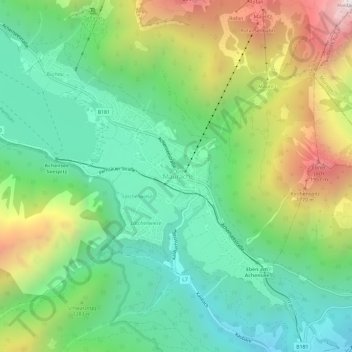
Name: Maurach topographic map, elevation, terrain.
Location: Maurach, Eben am Achensee, Bezirk Schwaz, Tyrol, 6212, Austria (47.40390 11.72981 47.44390 11.76981)
Average elevation: 3,927 ft
Minimum elevation: 2,241 ft
Maximum elevation: 7,149 ft
Thank you for supporting this site ❤️
Make a donation
Make a donation
Gear up for your next adventure:
As an Amazon Associate, this site earns from qualifying purchases at no extra cost to you.
Other topographic maps
Click on a map to view its topography, its elevation and its terrain.