
Cando topographic map
Interactive map
Click on the map to display elevation.
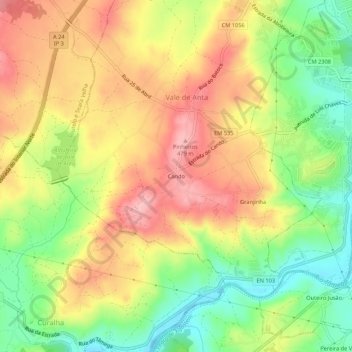
Cando topographic map, elevation, terrain
About this map
Name: Cando topographic map, elevation, terrain.
Location: Cando, Vale de Anta, Chaves, Vila Real, 5400-581, Portugal (41.71222 -7.52463 41.75222 -7.48463)
Average elevation: 1,342 ft
Minimum elevation: 1,106 ft
Maximum elevation: 1,562 ft