
Elijah Clark State Park topographic map
Interactive map
Click on the map to display elevation.
About this map
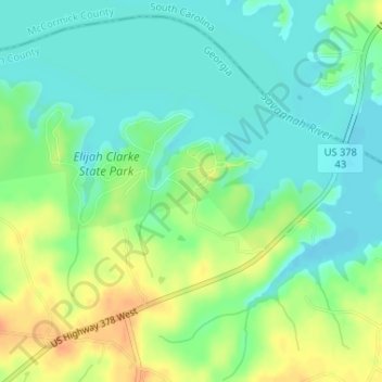
Name: Elijah Clark State Park topographic map, elevation, terrain.
Average elevation: 367 ft
Minimum elevation: 318 ft
Maximum elevation: 443 ft
Other topographic maps
Click on a map to view its topography, its elevation and its terrain.
Lincolnton
United States > Georgia > Lincoln County
Lincolnton, Lincoln County, Georgia, United States
Average elevation: 449 ft