
Kãyɨlalɨ topographic map
Interactive map
Click on the map to display elevation.
About this map
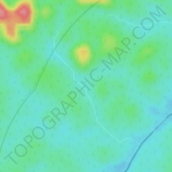
Name: Kãyɨlalɨ topographic map, elevation, terrain.
Location: Kãyɨlalɨ, Yawalu, Cayenne, French Guiana, France (2.55695 -52.56864 2.57516 -52.55496)
Average elevation: 364 ft
Minimum elevation: 282 ft
Maximum elevation: 591 ft
Other topographic maps
Click on a map to view its topography, its elevation and its terrain.
Crique Gaan Daaye
France > French Guiana > Papaichton
Crique Gaan Daaye, Papaichton, Saint-Laurent-du-Maroni, French Guiana, 97316, France
Average elevation: 942 ft
Saül
Saül, Arrondissement de Saint-Laurent-du-Maroni, French Guiana, 97314, France
Average elevation: 528 ft
Masikili Iwɨtɨ
France > French Guiana > Camopi
Masikili Iwɨtɨ, Camopi, Arrondissement de Saint-Georges, French Guiana, 97330, France
Average elevation: 305 ft
Plateau à l'Est
France > French Guiana > Saül
Plateau à l'Est, Saül, Arrondissement de Saint-Laurent-du-Maroni, French Guiana, 97314, France
Average elevation: 735 ft
Remire-Montjoly
Remire-Montjoly, Arrondissement de Cayenne, French Guiana, 97354, France
Average elevation: 59 ft
Cayenne
France > French Guiana > Cayenne
Cayenne, Arrondissement de Cayenne, French Guiana, 97300, France
Average elevation: 3 ft
Matoury
France > French Guiana > Matoury
Matoury, Cayenne, French Guiana, 97351, France
Average elevation: 36 ft
Tampak
France > French Guiana > Camopi
Tampak, Camopi, Cayenne, French Guiana, 97330, France
Average elevation: 341 ft
Kourou
France > French Guiana > Kourou
Kourou, Cayenne, French Guiana, 97310, France
Average elevation: 115 ft