
Sultanbeyli topographic map
Interactive map
Click on the map to display elevation.
About this map
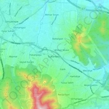
Name: Sultanbeyli topographic map, elevation, terrain.
Location: Sultanbeyli, Istanbul, Marmara Region, Turkey (40.93129 29.24472 41.00488 29.31194)
Average elevation: 564 ft
Minimum elevation: 240 ft
Maximum elevation: 1,752 ft