Pen ar C'hra topographic map
Interactive map
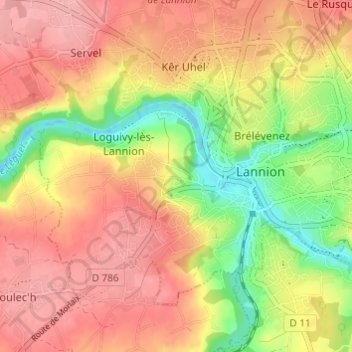
Click on the map to display elevation.
About this map
Name: Pen ar C'hra topographic map, elevation, terrain.
Average elevation: 203 ft
Minimum elevation: -13 ft
Maximum elevation: 344 ft

Click on the map to display elevation.
Name: Pen ar C'hra topographic map, elevation, terrain.
Average elevation: 203 ft
Minimum elevation: -13 ft
Maximum elevation: 344 ft