
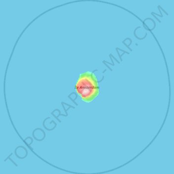
New Amsterdam Island topographic map
Interactive map
Click on the map to display elevation.
About this map
Name: New Amsterdam Island topographic map, elevation, terrain.
Average elevation: 20 ft
Minimum elevation: 0 ft
Maximum elevation: 2,785 ft
Other topographic maps
Click on a map to view its topography, its elevation and its terrain.
Juan de Nova Island
France > French Southern and Antarctic Lands
Juan de Nova Island, Scattered Islands in the Indian Ocean, French Southern and Antarctic Lands, France
Average elevation: 0 ft
Port-aux-Français
France > French Southern and Antarctic Lands
Port-aux-Français, Kerguelen Archipelago, French Southern and Antarctic Lands, France
Average elevation: 46 ft
Mount Calliope
France > French Southern and Antarctic Lands
Mount Calliope, Kerguelen Archipelago, French Southern and Antarctic Lands, France
Average elevation: 335 ft
Possession Island
France > French Southern and Antarctic Lands
Possession Island, French Southern and Antarctic Lands, France
Average elevation: 43 ft
Mont de la Dives
France > French Southern and Antarctic Lands
Mont de la Dives, Saint Paul and New Amsterdam Islands, French Southern and Antarctic Lands, France
Average elevation: 2,152 ft
Kerguelen Archipelago
France > French Southern and Antarctic Lands
Kerguelen Archipelago, French Southern and Antarctic Lands, France
Average elevation: 125 ft
Penguin Island
France > French Southern and Antarctic Lands
Penguin Island, French Southern and Antarctic Lands, France
Average elevation: 151 ft